Woven Gradients
Fall 2024

PROJECT BRIEF
Create a building informed by extensive site analysis within the Bonnet Carre Spillway
The Spillway- a uniquely Louisiana site that floods under the orders of the Army Corps of Engineers in response to storm surge in the Mississippi River and Lake Pontchartrain.

Much like the rest of Louisiana, the spillway is marred by an underlying of historical exploitation and modern extraction making this a landscape dominated by corporate interests.


PERFORATED LANDSCAPE
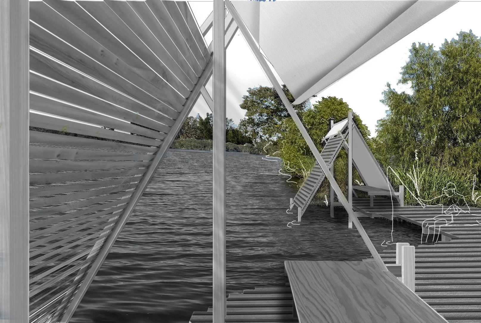
I wanted to riff on the existing architecture of NORCO’s architecture, namely the huge cylindrical holding tanks that dominate the aerial view of oil developments. I worked to integrate this dominant circular form in a way that feels like it is reclaiming a part of this landscape.
So I began to think of the circle as a void to remain natural and wrap my piece around it, molding it in order to create an experience of the ecological gradient of land to water in a new and more visceral way.

and yet, this massive piece of man-made infrastructure, meant in many ways to strong arm one of the biggest rivers in the world, has accidentally created a thriving ecosystem.
this presents an interesting opportunity to celebrate this reclaimation. not control it. or dominate it. or dissect it. but experience it.

ECOLOGICAL GRADIENT
There is an ecological gradient that spans the spillway and neighboring development and also extends from the water to the tree canopy. Therefore I started to play with restitching part of the coastline in order to cultivate an experience of each part of the gradient and in some places exacerbate it.
in flux
Importantly given the unique nature of the site (particularly, the fact that my site would be inundated with water in anything above a category 1 storm) I decided on a design for disassembly approach


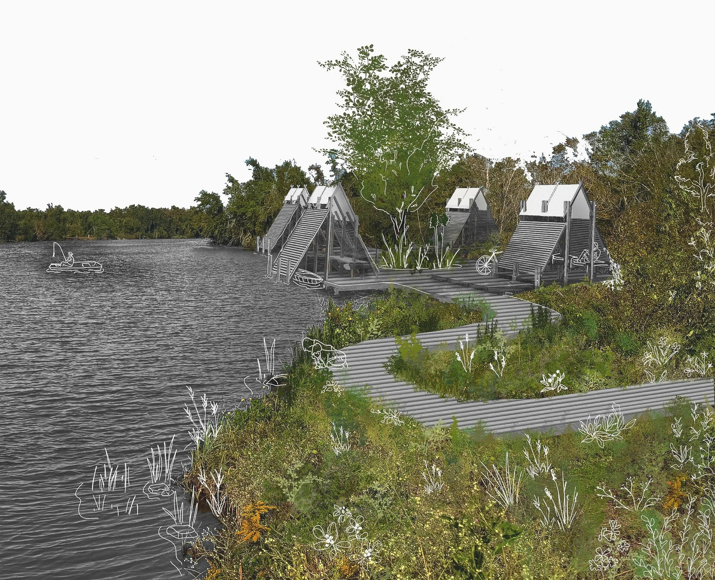
Land’s Edge
fishing_hiking_birdwatching

CANOPY
hiking_MountainBiking
There is an important ecological gradient that spans the spillway with the portion abutting the Mississippi River being made up of hard-packed, moderately developed land and that along Lake Pontchartrain being largely left to nature’s own devices. So the boundary that marks the transition between the wild ecosystem and human development is along Interstate 60, which also provides access to the outdoor recreation points in the park, including boat launch, mountain biking trails, and an existing campground that is essentially a glorified parking lot.
Zooming in on the transition zone along the gradient, we can see the convergence between extreme development with the large NORCO refining plant, moderate development within the Spillway, and this relatively “wild” area. Therefore by situating my site on the edge of access, I can also take advantage of the ample tree cover to cultivate the feeling of remote nature and privacy.
500 feet


WATER
boating_kayaking_fishing
1 mile
SITE PLAN